
Kenya Wildlife Conservancies Association logoKenya Wildlife Conservancies Association (KWCA) logo
Resources

Kenya’s conservancies, mapped

Kenya’s wildlife conservancies mapped — the national interactive map, the landscape association and conservancy-type web maps, the spatial data behind them, and how mapping underpins conservancy planning on the ground.
Why we map

Mapping made the conservancy movement visible

You cannot plan for, invest in or defend a landscape you cannot see. Putting conservancies on a map has been one of KWCA’s most consequential pieces of work.

In 2016 KWCA published the first comprehensive national map of Kenya’s wildlife conservancies. It documented 119 of the roughly 160 conservancies then in existence — 55% on community land, 30% on private land and 15% group ranches — and grouped them into the regional divisions KWCA still works through today. The spatial data for around 40 further conservancies could not be included, because boundaries were still under negotiation or had never been mapped at all.

That first map was, in KWCA’s own words, “the result of a herculean task of collating, geo referencing and interpretation of data from a myriad of sources and map formats”. It drew on data held by Kenya Wildlife Service (KWS), the African Wildlife Foundation (AWF), WWF and the regional associations — among them Northern Rangelands Trust, South Rift Association of Landowners, Maasai Mara Wildlife Conservancies Association, Laikipia Wildlife Forum and Amboseli Ecosystem Trust.

It was an important step in documenting how conservancies had evolved, and in building the case for conservancies as a mechanism for conserving biodiversity alongside sustainable community development. The interactive map below is the current expression of that work.
Read the 2016 map announcement →
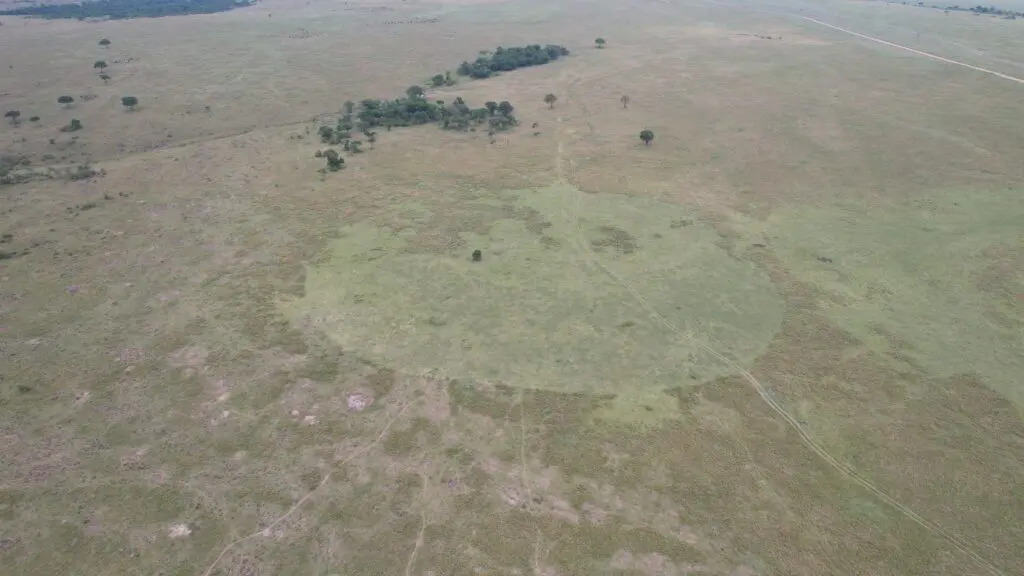
Rejuvenated grassland on the site of a former mobile boma in Mara North Conservancy
Interactive maps

Explore the conservancy maps

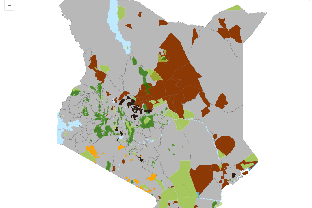
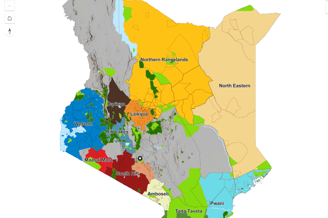
Kenya’s conservancies mapped from several angles — the national picture, the regional landscape associations that coordinate conservancies on the ground, and the split by conservancy type. The national map is live below; the rest open full-screen in ArcGIS. Read the notes further down before citing boundaries.

National map of conservancies

Every mapped conservancy in the country on a single basemap. Pan and zoom between Kenya’s conservancy landscapes, and select a conservancy to see where it sits and who it borders.
Open full screen in ArcGIS →

What the dataset covers

224
Member conservancies in the KWCA directory
28
Counties with member conservancies
12
Conservancy regions across the country
Go deeper

Spatial resources across the site

State of Conservancies

The national picture in numbers — area under conservation, conservancy types, growth over time and the gaps that remain.
View the report →

Member conservancies

All 224 member conservancies, browsable by county, region and landscape association — the tabular companion to the map.
Browse the directory →

Landscape associations

The 12 landscape associations that coordinate conservancies on the ground, and the areas each of them covers.
See the landscapes →

Conservation planning & mapping

How KWCA supports conservancies and communities to produce land use plans, map resources and secure boundaries.
See the programme →

Publications library

Reports, strategies, guides and factsheets from KWCA and its partners — including the reports this mapping work feeds.
Browse publications →

Request spatial data

Need conservancy boundaries or attribute data for research, planning or reporting? Tell us what you need and we will point you to the right source.
Get in touch →
Using the data

Before you cite these maps

Conservancy mapping is a living exercise, not a finished cadastre. A few things worth knowing before you reuse anything you find here:

  • Boundaries are indicative. They are compiled for planning and communication, not for legal, cadastral or land-adjudication purposes.
  • Coverage is incomplete by design. Conservancies whose boundaries are still under negotiation, or that have never been surveyed, are not shown.
  • The maps and the directory are not the same thing. Each conservancies layer is a dated snapshot of mapped members, so a map will normally show fewer conservancies than the member directory, which is kept current.
  • Conservancy status changes. Conservancies form, merge, expand and occasionally lapse — always check the date of the dataset you are working from.
  • Ask before you republish. Some layers originate with partners including KWS, AWF, WWF and the landscape associations, and carry their own terms of use.

If you need an authoritative extract, a specific attribute table, or written permission to reuse a layer, contact the KWCA secretariat.


More resources

Explore more resources

Maps, publications, news and answers — everything we publish for conservancies, partners and researchers, free to use.

Latest

Publications

FAQs

Need conservancy spatial data?

Tell us what you are mapping and we will point you to the right dataset, report or member of the team.

Sign up for our newsletter

Get the latest stories, reports and milestones from Kenya’s conservancy network, straight to your inbox.
IUCN International Union for Conservation of Nature logoNGOsource Equivalency Determination on File badge
© 2013–2026 Kenya Wildlife Conservancies Association
Privacy Policy Terms of Use Complaints Policy